IMPORTANT TO NOTE
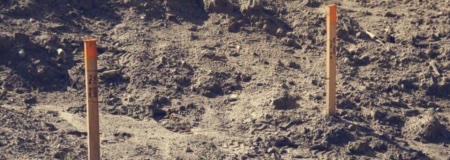
As the “Purchaser” of a house, you are the developer. It is your reasonable to identify all of the pegs, services and the position of the house by having a surveyor or licenced professional provide you with the correct information.
Haines House Haulage is the agent for the developer (the purchaser) and it is our job is to deliver the building to the marked position on the site and install the standard foundations as per the plan provided. Haines is only qualified to drill the pile hole and pour concrete to provide the pile under the house. It is important to engage the correct surveyor for your job.
It is the Purchasers reasonability to identify all of the following:
- Boundary pegs.
- Power Services underground
- All drainage and public drainage that may be affected.
- Heights and finished floor levels
In some cases the Purchase must dig up the ground or engage the services of a professional that can survey the public drainage to ensure it is sited and not damage when the pile holes are drilled.
The following type of survey plans will be required to give to the designer to make sure the building goes in the correct position:
Topographic Surveys
A Topographical Survey involves locating certain features on the ground before referencing them to a coordinate system – to then build a digital 3D model. This model provides engineering designers and architects with the information they need to complete their designs.
We work closely with the designer right from the beginning to ensure that the right information is being delivered quickly, through seamless communication. We always install a site datum point, so when construction begins the contractor can easily refer the design back to our original survey information.
Boundary Surveying
Licensed surveyors will provide you with accurate data and confidence to accurately establish your boundaries, meeting all legal requirements.
It is important to know where your property boundaries are. Uncertain boundaries can cause disputes between neighbours and complicate future development. The original wooden pegs that mark your property boundaries have a limited life expectancy, so it is often necessary to remark them. The best way to define your property boundaries is with a boundary survey.
Surveying underground Drainage
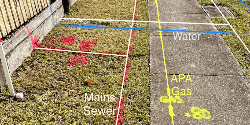
Underground utilities are critical infrastructure that requires specialised equipment to locate. It’s important to employ a licenced professional to determine exactly where they are located. The council records cannot be relied upon to use as a reference. There are Pipe and utility Surveyors who can provide the information accurately.
If construction workers accidentally hit one of these utilities, it can result in costly repairs, project delays, damage to the environment and even serious injury or death. This is why it is critical to locate, site and mark out all underground utilities before any excavation or construction begins.
Easement Surveys
Sometimes you may be routinely required to create easements or covenants around existing or new assets, creating a survey plan and working with lawyers to have the land titles updated.
Easements give you a right to use another’s land for a specified activity ie access. Having the easement created and your land title updated protects these rights even if either property is sold.
Floor level Surveys
Surveys of floor levels. Councils often require that floor levels be constructed at a minimum level to avoid flooding or height to boundary infringements. Surveyors can quickly determine the floor level by using a datum that is known. (IE mark on peg or fence). When Haines delivers the house we will construct the foundations to the finished floor height that has been pre-determined.
